'%3e%3crect%20x='0.25'%20y='0.25'%20width='27.5'%20height='19.5'%20rx='1.75'%20fill='white'%20stroke='%23F5F5F5'%20stroke-width='0.5'/%3e%3cmask%20id='mask0_503_2632'%20style='mask-type:alpha'%20maskUnits='userSpaceOnUse'%20x='0'%20y='0'%20width='28'%20height='20'%3e%3crect%20x='0.25'%20y='0.25'%20width='27.5'%20height='19.5'%20rx='1.75'%20fill='white'%20stroke='white'%20stroke-width='0.5'/%3e%3c/mask%3e%3cg%20mask='url(%23mask0_503_2632)'%3e%3cpath%20fill-rule='evenodd'%20clip-rule='evenodd'%20d='M2%200C0.895431%200%200%200.895431%200%202V8H8V0H2ZM12%200V8H28V2C28%200.895431%2027.1046%200%2026%200H12ZM28%2012H12V20H26C27.1046%2020%2028%2019.1046%2028%2018V12ZM8%2020V12H0V18C0%2019.1046%200.895431%2020%202%2020H8Z'%20fill='%23EF264D'/%3e%3c/g%3e%3c/g%3e%3cdefs%3e%3cclipPath%20id='clip0_503_2632'%3e%3crect%20width='28'%20height='20'%20rx='2'%20fill='white'/%3e%3c/clipPath%3e%3c/defs%3e%3c/svg%3e)



The Challenge
Like many other farms, the business faces growing expectations to reduce the use of crop protection products – from society, consumers and policymakers – while continuing to operate efficiently and profitably.
Frandsbjerg Agro is a 2,000-hectare arable farm near Hobro. Since 2024, Frandsbjerg Agro has used CropUp for spot spraying based on drone imagery and was therefore already familiar with the platform when the Satellite Prediction module was introduced in the winter of 2025.
The module attracted particular interest because it provides another way to target field applications and reduce inputs where possible. Satellite Prediction does not solve the challenge on its own, but it can be one of several tools that help the farm meet new requirements while maintaining efficient production.
The Solution
Satellite imagery
Select one or more fields from the satellite imagery and choose a date.
AI analysis
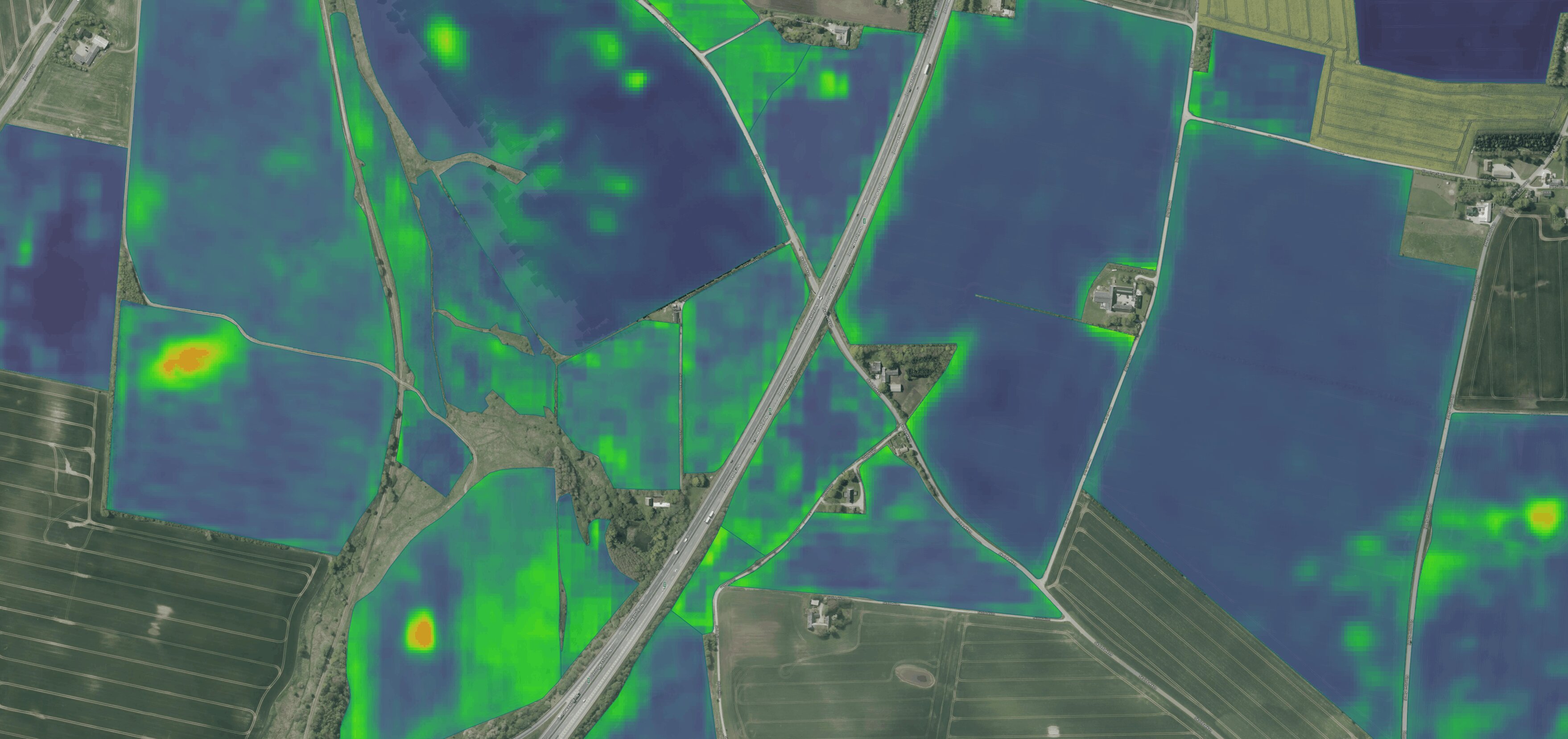
The AI model analyses five years of imagery and shows how weed pressure varies across the field.
Rate adjustment and redistribution
Use the level of weed pressure to decide where to increase or decrease the application rate.
Export and application
Download the finished spray map for treatment in the field.
Results
Reduced herbicide use
15%
Total savings during the season
€11,000
Conclusion
The satellite module provides a picture of expected weed pressure across the field, making it possible to target applications more precisely and thereby reduce the use of crop protection products.