'%3e%3crect%20x='0.25'%20y='0.25'%20width='27.5'%20height='19.5'%20rx='1.75'%20fill='white'%20stroke='%23F5F5F5'%20stroke-width='0.5'/%3e%3cmask%20id='mask0_503_2632'%20style='mask-type:alpha'%20maskUnits='userSpaceOnUse'%20x='0'%20y='0'%20width='28'%20height='20'%3e%3crect%20x='0.25'%20y='0.25'%20width='27.5'%20height='19.5'%20rx='1.75'%20fill='white'%20stroke='white'%20stroke-width='0.5'/%3e%3c/mask%3e%3cg%20mask='url(%23mask0_503_2632)'%3e%3cpath%20fill-rule='evenodd'%20clip-rule='evenodd'%20d='M2%200C0.895431%200%200%200.895431%200%202V8H8V0H2ZM12%200V8H28V2C28%200.895431%2027.1046%200%2026%200H12ZM28%2012H12V20H26C27.1046%2020%2028%2019.1046%2028%2018V12ZM8%2020V12H0V18C0%2019.1046%200.895431%2020%202%2020H8Z'%20fill='%23EF264D'/%3e%3c/g%3e%3c/g%3e%3cdefs%3e%3cclipPath%20id='clip0_503_2632'%3e%3crect%20width='28'%20height='20'%20rx='2'%20fill='white'/%3e%3c/clipPath%3e%3c/defs%3e%3c/svg%3e)


Plan flight
Start your mission with CropUp's intuitive planning tools.
We map weeds in different categories, crops, soil, and tractor tracks. You can then choose what to spray, your preferred buffer zone size, and dosage. We see an average saving of around 75%.
We map weeds in different categories, crops, soil, and tractor tracks. You can then choose what to spray, your preferred buffer zone size, and dosage. We see an average saving of around 75%.
In CropUp, you choose which terminal we should export the file to. Currently, we can create files for over 10 different terminals.
In CropUp, you choose which terminal we should export the file to. Currently, we can create files for over 10 different terminals.
We're looking at several regulations limiting spraying options. By using spot spraying, you can be ahead of upcoming requirements.
We're looking at several regulations limiting spraying options. By using spot spraying, you can be ahead of upcoming requirements.
The CropUp platform is developed in collaboration with crop consultants, farmers, and knowledge institutions. This ensures you have the necessary tools at hand to get a spray map exactly how you want it.
The CropUp platform is developed in collaboration with crop consultants, farmers, and knowledge institutions. This ensures you have the necessary tools at hand to get a spray map exactly how you want it.
From flight to spray map
Start your mission with CropUp's intuitive planning tools.
Capture high-resolution imagery of your fields, and upload the data.
CropUps advanced AI accurately identifies weeds and crops down to the centimetre. Processing takes 3–72 hours.
Generate a spray map tailored precisely to your needs before exporting it to the terminal format you require.


;}.cls-3{fill:url(%23radial-gradient);}.cls-4{fill:%23004312;}.cls-5{fill:%23fff;}%3c/style%3e%3cclipPath%20id='clip-path'%20transform='translate(-7.37%20-1.26)'%3e%3cpath%20class='cls-1'%20d='M154.67,39.26c-19.33.83-38.76,1.92-56.82,3.12L91.73,6.8h68.68l1.3,17H128.93l1.31,9.1H154ZM336.44,6.8H270l-2.53,31.41c10.9.25,21.5.58,31.72,1l2-15.1h8.81c11.61,0,10.36,5,8.93,13.63-.13.83-.25,1.58-.37,2.28,11.12.51,21.65,1.07,31.46,1.64,2-8.63,4.1-17.55,4.1-17.55C356.24,13.11,348.89,6.8,336.44,6.8ZM229.56,37.66,208.93,6.8h-38.4l1.8,31.78c17.1-.59,33.75-.94,48.89-.94Zm6.65.05q10.33.07,20.4.27L258.7,6.8H237.78ZM82.57,6.8H14.17L26,48.71C30.3,48.18,36.32,47.5,41.08,47c2.4-.24,4.92-.49,7.55-.73,3.42-.32,7-.65,10.77-1,6.65-.57,13.79-1.14,21.29-1.7l-2.1-9H56.83L54.35,24H86.18Zm279.16,0L357.57,24h18.59l-4.45,19c13.93.91,25.68,1.78,34.67,2.44L412.83,24h20.76L439.37,6.8Z'/%3e%3c/clipPath%3e%3cradialGradient%20id='radial-gradient'%20cx='-357.88'%20cy='245.45'%20r='121.9'%20gradientTransform='matrix(3.4,%20-0.05,%200.02,%200.51,%201489.98,%20-104.11)'%20gradientUnits='userSpaceOnUse'%3e%3cstop%20offset='0.04'%20stop-color='%23fff'/%3e%3cstop%20offset='0.07'%20stop-color='%23e8f1e3'/%3e%3cstop%20offset='0.13'%20stop-color='%23abcc9b'/%3e%3cstop%20offset='0.23'%20stop-color='%234c9329'/%3e%3cstop%20offset='0.23'%20stop-color='%234b9228'/%3e%3cstop%20offset='0.28'%20stop-color='%232f7d24'/%3e%3cstop%20offset='0.34'%20stop-color='%23196d21'/%3e%3cstop%20offset='0.39'%20stop-color='%230c6320'/%3e%3cstop%20offset='0.44'%20stop-color='%2307601f'/%3e%3c/radialGradient%3e%3c/defs%3e%3cpath%20class='cls-1'%20d='M48.63,46.26c3.42-.32,7-.65,10.77-1C55.64,45.61,52.05,45.94,48.63,46.26Z'%20transform='translate(-7.37%20-1.26)'/%3e%3cpath%20d='M80.69,43.59h0c-7.5.56-14.64,1.13-21.29,1.7C66.05,44.72,73.19,44.15,80.69,43.59Z'%20transform='translate(-7.37%20-1.26)'/%3e%3cg%20class='cls-2'%3e%3crect%20class='cls-3'%20width='441.35'%20height='83.09'/%3e%3c/g%3e%3cpath%20class='cls-4'%20d='M363.46,78.24h33.06l8.7-29c-5.56-.35-18.13-1.06-34.54-1.88Z'%20transform='translate(-7.37%20-1.26)'/%3e%3cpath%20class='cls-4'%20d='M134.47,62.57l-1.34-9.35h23l-1-9.56c-14.64.28-36,1.11-56.71,2L104,78.24h61.45l-1.15-15.67Z'%20transform='translate(-7.37%20-1.26)'/%3e%3cpath%20class='cls-4'%20d='M235.55,50.66,232,42.59c-3.17,0-6.1-.05-8.7-.05-16.26,0-36.32.25-50.71.61l2,35.09h18.33l-.39-35.46L219,78.24h34.9L256.27,43c-7.2-.16-14.12-.3-20.31-.38Z'%20transform='translate(-7.37%20-1.26)'/%3e%3cpath%20class='cls-4'%20d='M316.6,50.16c-2.2,9.85-7.38,12.23-15,12.23h-5.51l2.45-18.14c-9.64-.34-20.6-.68-31.44-1l-2.83,34.95H317c11.68,0,25.57-5.92,29.32-20.9.27-1.06,1.35-5.6,2.62-11-9.88-.46-20.45-.92-31.27-1.36C317.4,46.55,317.05,48.15,316.6,50.16Z'%20transform='translate(-7.37%20-1.26)'/%3e%3cpath%20class='cls-4'%20d='M44.08,48.35l-1.79.12L41.08,47C36.32,47.5,30.3,48.18,26,48.71l8.29,29.53H66.85L61.48,55H83.36l-2-8.52C66.23,47.19,52.69,47.88,44.08,48.35Z'%20transform='translate(-7.37%20-1.26)'/%3e%3cpath%20class='cls-5'%20d='M256.61,38q-10.06-.19-20.4-.27L236,42.64c6.19.08,13.11.22,20.31.38Z'%20transform='translate(-7.37%20-1.26)'/%3e%3cpath%20class='cls-5'%20d='M232,42.59l-1.67-3.78-.77-1.14c-2.77,0-5.55,0-8.34,0-15.14,0-31.79.34-48.89.93l.26,4.57c14.39-.36,34.45-.61,50.71-.61C225.9,42.54,228.83,42.56,232,42.59Z'%20transform='translate(-7.37%20-1.26)'/%3e%3cpath%20class='cls-5'%20d='M80.69,43.59c-15,1.12-28.57,2.28-39.62,3.4l1.22,1.48c.58,0,1.13-.08,1.79-.11,8.61-.48,22.15-1.17,37.29-1.89Z'%20transform='translate(-7.37%20-1.26)'/%3e%3cpath%20class='cls-5'%20d='M154.67,39.26c-19.33.83-38.76,1.92-56.82,3.12l.57,3.31c20.71-.92,42.07-1.75,56.71-2Z'%20transform='translate(-7.37%20-1.26)'/%3e%3cpath%20class='cls-5'%20d='M299.21,39.18c-10.22-.38-20.82-.72-31.72-1l-.41,5.09c10.84.28,21.8.62,31.44,1Z'%20transform='translate(-7.37%20-1.26)'/%3e%3cpath%20class='cls-5'%20d='M406.38,45.41c-9-.66-20.74-1.53-34.67-2.44l-1,4.42c16.41.82,29,1.53,34.54,1.88Z'%20transform='translate(-7.37%20-1.26)'/%3e%3cpath%20class='cls-5'%20d='M350.08,41.63c-9.81-.57-20.34-1.13-31.46-1.63-.32,1.88-.6,3.42-.91,5,10.82.44,21.39.9,31.27,1.36C349.34,44.82,349.71,43.23,350.08,41.63Z'%20transform='translate(-7.37%20-1.26)'/%3e%3c/svg%3e)


Turn RGB drone images into precise weed maps with AI detection of crop, soil and multiple weed categories. Use CropUp to convert the results into customised spray maps for targeted herbicide application.
10 EUR / Ha
Create variable-rate application maps from multispectral drone imagery. Similar to satellite-based NDVI workflows, but with the higher resolution and field-level detail of drone data.
4.6 EUR / Ha
Automatically count plants across the field and analyse differences in plant population between areas. Use the maps to identify weak zones and plan spot seeding in poorly established areas.
6.5 EUR / Ha
Measure distances and areas directly on RGB or multispectral drone maps. Useful for documenting field damage, drought impact, insurance cases and other in-field observations.
4 EUR / Ha
Click to read more
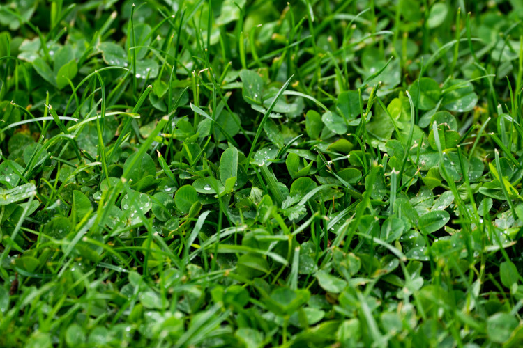
CropUp detects various weeds on grass and clover fields, such as dock and dandelion. CropUp also estimates and maps the distribution of clover and soil, such that fertiliser usage can be optimised.
Click to read more
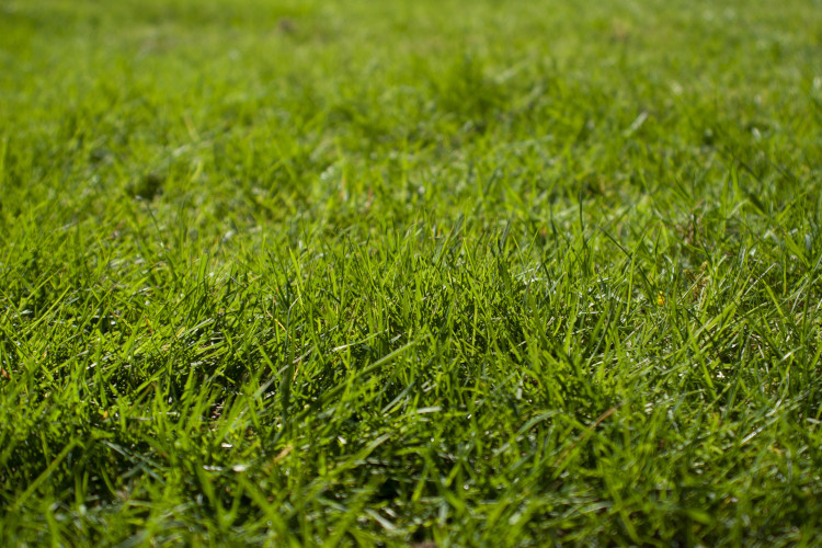
CropUp identifices problematic areas in fields for grass-seeds. In some fields it is possible to differentiate between species depending on crop, weeds and the amount of weeds.
Click to read more
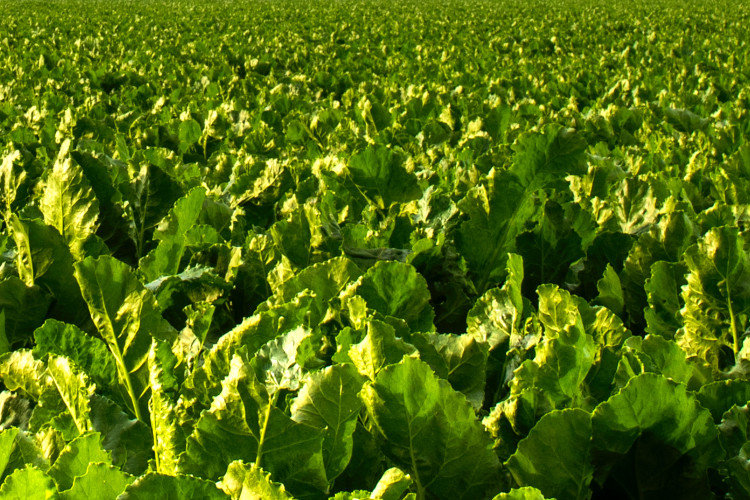
CropUp can detect root weeds in and between rows in beets, spinach, beans and potatoes.
Click on a case to read more
Click to read more
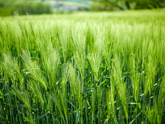
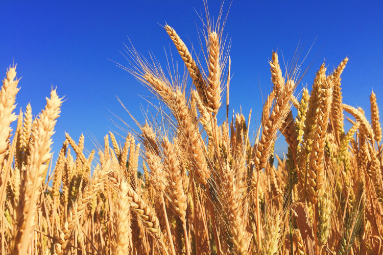
CropUp can map weeds in wheat fields in spring and before harvest. In the spring an estimate can be made on problematic areas and early weed Infestations, while a more accurate map can be made before harvest where species-differentation is possible.
CropUp detects both root weeds, grass weeds, and other weeds in wheat and spring barley fields overflown in the spring.
Click on a case to read more
Click to read more
CropUp continously works on improving the algorithms and supporting more crop and weed detections. If you have any requests, don't hesitate to reach out to us, so we can investigate how to support it in CropUp!
CropUp is a tool for those who want to achieve better yields with less chemicals. CropUp helps enable precision spraying with the machinery you have available. CropUp uses advanced artificial intelligence (AI) and drone images to recognize various weeds and crops at the plant/leaf level, and maps them precisely.
No, you don't need to own your own drone. We work with most consulting firms in the country, so there's a good chance your advisor can offer the flyover for you. However, be aware that you will have to pay 2-3x the price per hectare compared to flying yourself.
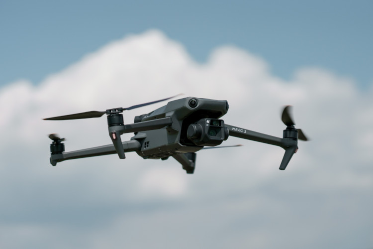
CropUp supports all of the most popular drones made for surveying: DJI Phantom 4 RTK, DJI Matrice 300/350 with Zenmuse P1, DJI Mavic 3 Enterprise/Multispectral, DJI Matrice 4 Enterprise. If you're planning on buying your own, we recommend the DJI Mavic 3 Enterprise with RTK or the Multispectral variant as these provide the best value for money, in an easy to carry package. Both options can be bought for less than 50.000 DKK including extra batteries and everything you might need. Should you want something new and an upgrade, Matrice 4 Enterprise would be the next step. Contact Geoteam who can help you get a drone and get started with CropUp.
We use standard RGB images. The artificial intelligence doesn't need multispectral data, which means you don't have to work with cumbersome multispectral images and you can survey a field up to 3 times faster.
This depends on how high you can fly while still being able to see the weeds - that is, what's the problem and how tall is the crop. With a DJI Mavic 3 Enterprise, you can fly between 40 and 100 hectares per hour. With a DJI Matrice 300/350 and a Zenmuse P1 camera, it's about double the capacity.
The AI always maps soil, crops, root weeds, grass weeds, and other weeds by default. Contact us or one of our partners at the agricultural associations if you want to hear if we can map your problem.
CropUp provides support for, amongst other things, AGCO, AG Leader, Amazone, Bogballe, Claas, John Deere, Kverneland, Topcon, Trimble, Fendt, Steerguide, Case IH, Müller-Elektronik


CropUp is developed by Akson Robotics in collaboration with farmers and agricultural consultants. Akson Robotics uses drones and AI to make precision farming profitable.
Spot spraying enables selective weed control, making weed management more efficient and cost-effective. At the same time, it improves crop yield.